 BY KATHRYN KELLY
Why was Lake Hiawatha at risk for flooding again this year? And why did Minneapolis Park Board Commissioner Musich make a special trip to Hiawatha Golf Course to warn the staff? Maybe it is because the Minnehaha Creek Watershed District (MCWD) is using a 45-year-old plan for controlling the water coming from Lake Minnetonka into Minnehaha Creek. The high rainfall in early summer exposed concerns with the plan and the decisions that were made.
The MCWD website states, “The operating plan for the Gray’s Bay Dam was designed to mimic the hydrologic conditions of Minnehaha Creek before urbanization, but it also accounts for changing weather.” Also, the operating plan says their goal is to reduce flooding on the lake by stabilizing Lake Minnetonka’s levels between the elevation of the low point on the previous fixed weir prior to 1979 (928.6 feet) and the Ordinary High-Water level (929.4 feet).
Why is this concerning? The top of the dam is at 930.0 feet. Thus, the operating plan allows only 16.8 inches of play from the lowest water level allowed in Lake Minnetonka to the overflow of the dam. How realistic is this with climate change and massive changes in the watershed due to development since 1979?

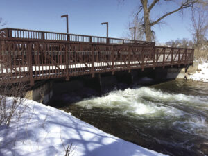
Gray’s Bay Dam
We researched what happened this year after being in a drought.
The operating plan states that the starting point for the lake level in the spring is supposed to be 928.6 feet. On March 20, 2024, the lake level was at 928.64 feet, the expected starting point.
The operating plan also states, “It is the policy of the district to operate the Headwater Control Structure to reduce flooding both on Minnehaha Creek and Lake Minnetonka. This is accomplished by controlling the discharge from Lake Minnetonka to Minnehaha Creek after ice-out (approximately April 15) until approximately mid-June. As a result, water is temporarily stored on the lake.”
In 2024, ice-out was declared on Lake Minnetonka on March 13, 2024. Yet, the MCWD did not start releasing any water from Lake Minnetonka until May 1. By that time the lake level had risen to 929.52, about 6 inches below the top of the dam. The reason stated for the late date was that spring precipitation finally removed the watershed from a drought classification. After May 1, due to high rainfall, the lake level fluctuated until it hit 929.92 feet on July 5, less than an inch below the top of the dam!! Throughout this timeframe, MCWD staff was increasing and decreasing the rate of flow through the dam, trying to balance the water coming from Lake Minnetonka with the water entering Minnehaha Creek from the lower watershed.
So, why had it increased to 929.52 feet before the MCWD started releasing water from the lake? We looked at precipitation levels for the MSP airport for March and April.
In March and April there were 4 periods of precipitation – March 24-26 (2.32 inches), April 7-8 (0.78 inches), April 16-17 (1.66 inches) and April 27-30 (1.5 inches). The first 3 were followed by 11, 7 and 9 days of little or no precipitation, respectively. Since ice-out on Lake Minnetonka was prior to this rainfall, it appears that the MCWD could have released water for any or all of these precipitation events to lower the lake level. The MCWD finally opened up the dam after the 4th rainfall (April 27-30) after holding onto about 6.26 inches of precipitation. Note: We also looked at Chanhassen rain statistics and the total rain from March 13 to April 30 was a comparable 6.08 inches.
Since the MCWD states that water can be released from Lake Minnetonka in a controlled manner after ice-out, why did the MCWD allow water to build up in Lake Minnetonka for almost one and a half months instead of releasing water to keep the lake at its lowest level? Based on this assessment, it appears that the problem was due to management decisions before the excessive rainfall occurred.
Also of concern is that the operating plan for the dam only allows the level of Lake Minnetonka to fall to 928.6 feet, or 16.8 inches below the top of the dam. According to the operating plan this level is based on the lowest level of the old dam which was replaced in 1979. So, the minimum level of Lake Minnetonka and the release of water is based on the composition of the watershed 45 years ago. Can this lake level be lowered to release more water at appropriate times to provide more storage in Lake Minnetonka for high rainfalls? The lowest lake level on record is 921.78 feet in 1937, almost 7 feet below the currently maintained lowest level.
And we looked at how many years the level of Lake Minnetonka hit or exceeded the top of the dam. 1906-1949 (1 time), 1950-1959 (3 times), 1960-1969 (3 times), 1970-1979 (2 times), 1980-1989 (4 times), 1990-1999 (3 times), 2000-2009 (4 times), 2010-2019 (4 times), 2020-2023 (0 times, so far). It appears that the height of the dam has become less and less effective as a structure for preventing flooding in the lower watershed.
During the last drought, we also found that the creek and Lake Hiawatha are filled with sand and silt from years of build-up. The rules for when to release water are based on the carrying capacity of the creek. Without periodic dredging of the whole length of the creek, it is continuing to lose its carrying capacity.
With all of the warnings of climate change, and the massive development of the watershed in the past 45 years, why would the MCWD still be working under these outdated parameters? It appears that Hiawatha Golf Course and Lake Hiawatha are the victim of outdated operating plans and questionable management regarding control of water in the watershed.
We have reached out to the MCWD but have not received any answers to our questions at this time.


