An Appeal to the readers of Southside Pride
Edwin Felien
v.
Brad Bourn, Minneapolis Park and Recreation Board
A WRIT OF MANDAMUS TO COMPEL THE MINNEAPOLIS PARK AND RECREATION BOARD TO PERFORM THEIR DUTY TO PROTECT THE PUBLIC WELFARE
Court File Number:
27-CV-19-10595
To be heard before the Honorable Patrick D. Robben on Aug. 12, 2019, at 9:45 a.m.
On July 15, 2019, The Minneapolis Park and Recreation Board sent out a document via email: “Hiawatha Golf Course Property Master Plan Facts and Misconceptions: Due Diligence on Data.” The document refers to the Barr Engineering Study: “Hiawatha Golf Course Area Water Management Alternatives Assessment Water Management Alternatives,” prepared for Minneapolis Park and Recreation Board, City of Minneapolis, and Minnehaha Creek Watershed District 6/21/2017.
https://www.minneapolisparks.org/_asset/x8rhm4/June-2017-Water-Management-Alternatives.pdf
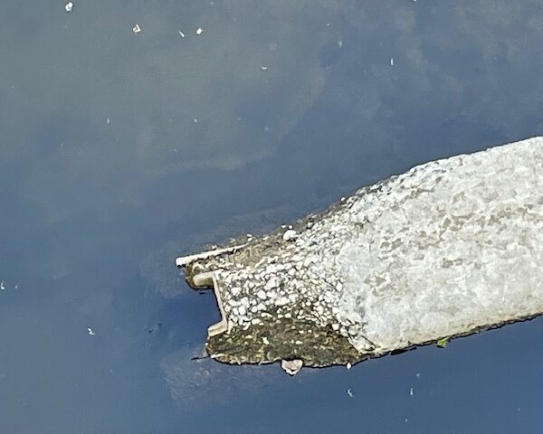
On page 23 of the Barr document is a profile map of Minnehaha Creek that indicates the control point for the water level is a rock weir under the 30th Avenue footbridge. Either this information is out of date, since many of the boulders blocking the course of Minnehaha Creek have been removed, or the removal of the boulders has not changed the control point and the rock weir is still the control point for the water level of Minnehaha Creek and Lake Hiawatha. In either case, it is essential for the Minneapolis Park and Recreation Board to commission a new survey that indicates the new profile of the level of obstructions blocking the exit of Minnehaha Creek from Lake Hiawatha.
On July 22, 2019, the Minneapolis Park and Recreation Board sent out a document via email: “Hiawatha Golf Course Property Master Plan Facts and Misconceptions: Groundwater Pumping and Dredging,” in which they say,
“An investigation of the creek revealed at least 19 introduced and natural downstream obstructions in the creek’s first 2,200 feet downstream of the lake, all of which have the potential to control the elevation of water in the lake to some degree.
“It’s not possible to remove all those obstructions, which include a regional sewer interceptor pipe measuring more than ten feet high and requiring an earthen cover. That structure was constructed in 1925, nine years before the course opened.”
As we said in our brief, the “regional sewer interceptor pipe” is the principal obstruction to the flow of Minnehaha Creek: “The highest point of a sewer line crossing Minnehaha Creek is 808 feet above sea level. If there were no other obstructions and the backfill, sand and silt flowed naturally downstream, removal of the rock weir could lower the water level and surrounding water table by 2.7 feet.” All other sewer lines or natural obstructions are below 808 feet. The two possible exceptions to this are the unused municipal gas line at 28th Avenue and the U.S. Army Corps of Engineers dam/weir at 27th Avenue. But it is a deliberate distortion to claim there are 19 obstructions when there are only two that could possibly rise above the 808 feet of the regional sewer interceptor.
Therefore, we ask this court to order the Minneapolis Park and Recreation Board to commission an updated profile survey of the obstructions in Minnehaha Creek from the outlet from Lake Hiawatha to Minnehaha Falls.
Further, we ask this court to order the Minneapolis Park and Recreation Board to cease making false and misleading statements regarding obstructions in Minnehaha Creek.


